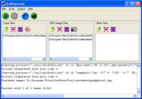
OziPhotoTool takes the digital photos with EXIF metatdata, and tracks from OziExplorer to determine where the GPS was when the photo was taken. Produces HTML and Gooogle Earth output. Check http://oziphototool.alistairdickie.com/download.html for smaller
OziPhotoTool combines the technology of a GPS receiver and a digital camera to automatically keep a record of where digital photos were taken. It is designed to be used in conjunction with OziExplorer. Most digital cameras have EXIF metadata stored as part of the photo. This includes is the date and time the photo was taken. Many GPS units have 'tracklogs'. The GPS keeps a record of points that the unit has traveled over, including the time at each point. OziExplorer can read tracks from many different GPS units. OziPhotoTool takes the digital photos with EXIF metatdata, and tracks from OziExplorer to determine where the GPS was when the photo was taken. As long as the GPS was in the same location as the camera this represents the location of the photo. OziPhotoTool outputs the linkage between the photo and its location by creating an OziExplorer waypoint file, generating map features on OziExplorer maps, watermarking the photos, embedding exif information in the photos, generating HTML output or generating Google Earth kml/kmz files. Check http://www.oziphototool.com/download.html for smaller download options
Whats new in version 2.8: Performance and stability update Requirements: 128M RAM Operating system: Win98,WinME,WinXP,Windows2000,Windows Vista Release notes: Minor Update
MagicBD is a graphic software which can be used to draw many kinds of iconographies, illustrations and sketch maps.It can also be used to edit images to process them or get some special effects.
Price: $28, Rating: 10, Downloads: 234 Download
Pos Free Photo Editor is a free photo editor from the authors of the best free professional photo editor - Photo Pos Pro free photo editor. The software is simple and very user friendly photo editor, that lets you easily view, and enhance your photos
Price: $0.00, Rating: 10, Downloads: 190 Download
Design over 10 photos by few mouse clicks. Easily create photo book, collage, calendar, greeting cards, wedding photos and more artworks.
Price: $39.95, Rating: 0, Downloads: 171 Download
Image Frame is a Photoshop-compatible plug-in for easy creation naturally-look 3D frame. Add frame and text to your photos. You can apply rectangular and elliptical frame, change frame profile, material, and lightening.
Price: $14.95, Rating: 10, Downloads: 160 Download
User Rating
Rating:2.2 out of
5 Based on13 ratings.
13 user reviews.